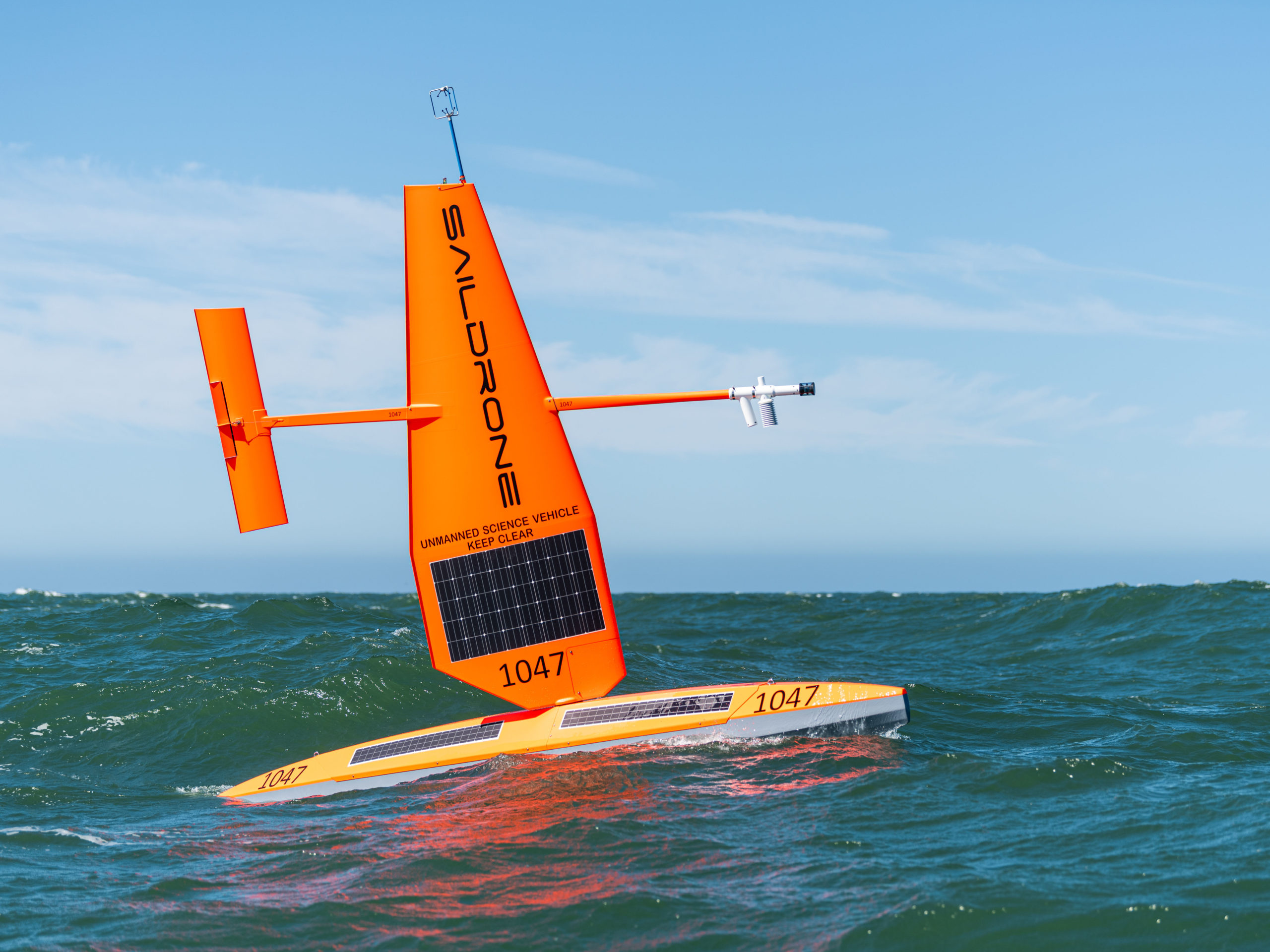
Hurricane Drones Heading Back to the Atlantic and the Gulf of Mexico

(August 3, 2022 – St. Petersburg, FL) – Saildrone has launched its second annual Hurricane mission, partnering with the National Oceanic and Atmospheric Administration (NOAA)’s Office of Oceanic and Atmospheric Research to send seven uncrewed surface vehicles (USVs) to brave the treacherous hurricane season, collecting more insights into how large and destructive hurricanes grow and intensify in the Atlantic Ocean and the Gulf of Mexico.
The Saildrone USVs proved themselves in the Atlantic Ocean during last year’s hurricane season, with SD 1045 sailing through the eyewall of Category 4 Hurricane Sam. Battling massive 100-foot waves and roaring 140 mph winds, the vehicle not only survived intact but sent back the first-ever live video footage from inside the eye of the monster storm.
This year, Saildrone will collect critical data from both the Atlantic Ocean and the Gulf of Mexico expanding the potential impact of the mission. This week, one of the USVs bound for an operation area in the eastern Gulf of Mexico, SD 1032 was deployed from Saildrone’s Ocean Mapping Headquarters in St. Petersburg, and another was deployed from Port Aransas, TX, for the western Gulf.
“We are excited to expand this effort to collect vital data in both the Atlantic and the Gulf of Mexico. We opened our Florida office earlier this year to support exactly this kind of mission, as well as our goal of mapping the entire sea floor around Florida,” said Saildrone CEO Richard Jenkins. “Combining in situ ocean data with a better understanding of the ocean floor, will help us predict both storm intensity and storm surges, keeping our coastal communities safer from these destructive events.”
NOAA predicts an above-average 2022 hurricane season, with up to 21 named storms and three to six major hurricanes. Hurricanes don’t only present a persistent threat to human safety in coastal cities, they also present a significant economic impact—hurricane damage in the US is estimated at around $54 billion annually. Understanding the physical processes of hurricanes is critical to improving forecasts of deadly storms, reducing property damage and loss of human life.
Saildrone USVs will gather key data throughout the 2022 Hurricane season. Saildrone Explorers, specifically designed to withstand the extreme conditions that occur during a hurricane weather system, are the only USVs capable of collecting this type of critical data.
The Atlantic Hurricane mission aims to improve understanding and predictability of tropical cyclone intensity changes and advance knowledge of the ocean-atmosphere interactions that fuel them. The saildrones will provide in situ data to the National Oceanic and Atmospheric Administration (NOAA)’s Pacific Marine Environmental Laboratory (PMEL) and Atlantic Oceanographic and Meteorological Laboratory (AOML), Saildrone’s scientific partners in this audacious mission. The data will also be valuable to other government and research groups.
The seven saildrones are a part of a larger NOAA endeavor to understand hurricane intensification. They will join an array of underwater gliders, surface drifters, profiling floats, and aerial assets to collectively gain deeper insight than ever before into the development of these killer storms. AOML scientists onboard NOAA’s P-3 and Gulfstream IV Hurricane Hunter aircraft will help gather weather observations from hurricanes, and the P-3 will also launch small uncrewed aerial systems to sample the atmosphere above.
“Uncrewed marine and aircraft systems have the potential to transform how NOAA meets its mission to better understand the environment,” said Capt. Philip Hall, director of NOAA’s Uncrewed Systems Operations Center. “These exciting emerging technologies provide NOAA with another valuable tool that can collect data in places we can’t get to with other observing systems.”
The saildrones will transmit meteorological and oceanographic in situ data in real time including air temperature and relative humidity, barometric pressure, wind speed and direction, water temperature and salinity, sea surface temperature, and wave height and duration.
NOAA Research will use the data collected by the saildrones to improve hurricane forecast models. The data will also be archived by NOAA’s National Environmental Satellite, Data and Information Service (NESDIS) and sent by NOAA in near real time to the World Meteorological Organization (WMO)’s Global Telecommunication System (GTS) where it is available for the world’s major forecast centers—some 20 agencies worldwide, including NOAA.
Earlier this summer, the rest of the fleet was deployed from Jacksonville, FL, and the US Virgin Islands, en route to locations in the Atlantic Ocean where scientists hope the saildrones will capture more of the incredible video, images, and data they collected in 2021.
For the full press release see: https://www.saildrone.com/press-release/2022-atlantic-gulf-mexico-hurricane-mission


